Cherokee (Arkansas River)
Morrilton, Arkansas · US Army Corps of Engineers
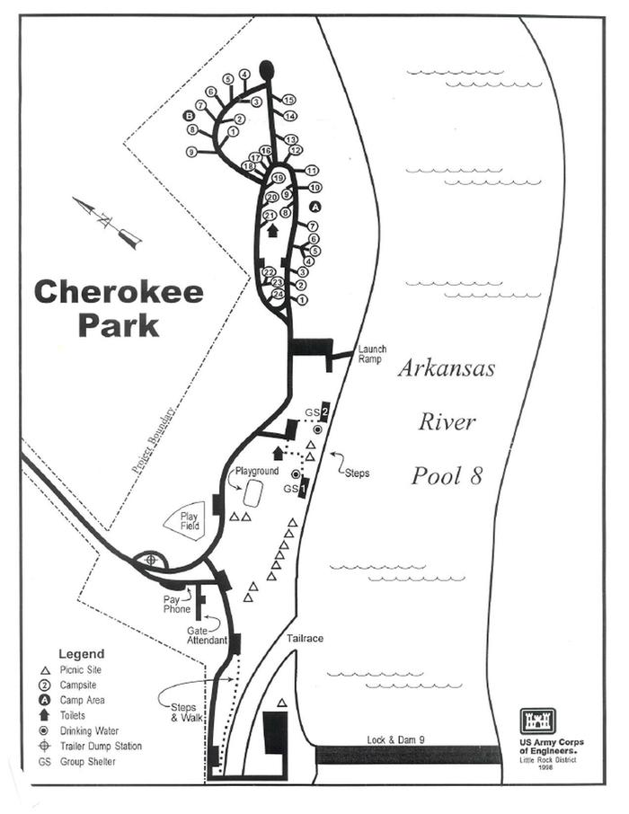
Photo: Recreation.gov
About
PLEASE NOTE: This is Cherokee Park on the Arkansas River in Morrilton, Arkansas. This is not Cherokee Park at Greers Ferry. You can download a park map HERE You can download a Customer Comment card HERE Special Event Permit Petit Jean State park is only a short drive away. Camping, picnics, boating, fishing, and nature watching are all highly prized at Cherokee park. For local information, please call (501) 500-1787 or call (501) 340-1004 for general information.Cherokee Campground offers 33 spacious campsites with 30 or 50 amp electric hookups and water, along with two large group picnic shelters. Amenities include a dock, hot showers, a boat ramp and playground. The campground is set on the McClellan-Kerr Arkansas River Navigation System, a series of navigation pools used to help ships navigate upstream toward Oklahoma. The Arkansas River is one of the Mississippi's largest tributaries, flowing 1,450 miles from the Rocky Mountains of Colorado, through to Kansas, Oklahoma and Arkansas. Wintering eagles can be seen in large numbers along the Arkansas River. Most of these eagles migrate from Canada and the U.S. Great Lakes region.
Directions
From Highway 64 in Morrilton, take AR 21 South. Then take Quincy drive to Cherokee Park.
Location
Map tiles © OpenStreetMap.
Details
- State
- Arkansas
- City / area
- Morrilton
- Agency
- US Army Corps of Engineers
- Parent area
- Arkansas River - Rockefeller Lake
- Campsites
- 33
- Reservable
- Yes
- Typical price
- $24–$75 / night
- Rating
- 4.07 / 5 (90 reviews on Recreation.gov)
- Equipment
- Tent, RV, Fifth Wheel
Nearby campgrounds
- TOAD SUCK 22.9 km away
- OLD POST ROAD 36.5 km away
- RIVER ROAD 38.9 km away
- QUARRY COVE 39.4 km away
- CARDEN POINT 41.0 km away
- CARTER COVE 45.2 km away