Westwater Group Site (Ranger Station)
Grand Junction, Colorado · Bureau of Land Management
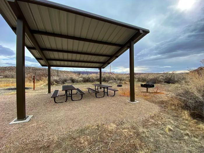
Photo: Recreation.gov
About
Welcome to the wild and remote canyons and rivers of Eastern Utah. The Westwater Group Site is located next to the Westwater Ranger Station; the take-out for the Ruby-Horsethief and put-in for the Westwater Canyon sections of the Colorado River. This site is ideal for large groups looking to camp along the river. The group site includes a shade shelter with picnic tables, a fire ring, and a vault toilet where groups of up to 30 people can gather. There are parking spaces for up to 10 vehicles. The site is adjacent to the Colorado River as it meanders through a valley. Views of Navajo Sandstone walls surrounding the valley can be seen from the site. The town of Moab, UT, Canyonlands National Park, and Arches National Park are located approximately 70 miles to the southwest. The cities of Grand Junction and Fruita, CO along with McInnis Canyons National Conservation Area and Colorado National Monument are located approximately 35 miles to the east.The Colorado River is known for extraordinary boating trips including the Ruby-Horsethief section up-river of Westwater Canyon and the Cataract Canyon and Grand Canyon sections downstream. The Ruby-Horsethief section of the Colorado River, from Loma, Colorado, to Westwater, Utah, is a 25-mile stretch of mostly flat-water with sections of Class I and II rapids. This section of the Colorado runs through beautiful red rock canyons and has many day hiking opportunities offering both solitude and exploration. Westwater Canyon offers boating excitement for experienced adventurers to test their skills navigating 11 named rapids ranging in difficulty from class I to class IV. While boating down the canyon, the area offers views of incredible geology and day hiking with glimpses of abandoned settler cabins and caves. Approximately 10,000 people float this section of the Colorado River each year. The 17-mile stretch is surrounded by the Westwater Wilderness Study Area. North of the site are many motorized and non-motorized trails. These trails include Kokopelli’s Trail , one of Colorado's and Utah's premiere mountain bike trails. It stretches 140 miles from Loma, CO to Moab, UT with elevations that rise to 8,400 feet and consists of four-wheel-drive roads and single-track trails.
Directions
From Grand Junction Colorado (westbound traffic): Take I-70 from Grand Junction for approximately 35 miles to exit 227. Turn south at the stop sign and proceed for nine miles to the Ranger Station and put-in. From the west (eastbound traffic): Take exit 227 on I-70, then head south at the stop sign. Proceed for nine miles to the Ranger Station and put-in. NOTE: Do NOT use exit 221 toward Sulpher when the roads are wet. It may be impassable with muddy conditions.
Location
Map tiles © OpenStreetMap.
Details
- State
- Colorado
- City / area
- Grand Junction
- Agency
- Bureau of Land Management
- Parent area
- Westwater Canyon River
- Campsites
- 1
- Reservable
- Yes
- Typical price
- $50 / night
- Rating
- 4.60 / 5 (5 reviews on Recreation.gov)
- Equipment
- Tent, RV, Trailer, Caravan/Camper Van, Pickup Camper, Fifth Wheel, Pop up, Boat
Nearby campgrounds
- Westwater Campground (Ranger Station) 0.2 km away
- Knowles Overlook Campground 8.3 km away
- Jouflas Campground 12.1 km away
- Rabbit Valley 13.1 km away
- SADDLEHORN CAMPGROUND 32.1 km away · dump mentioned
- Dewey Bridge Group Sites 35.6 km away