COUGAR PEAK LOOKOUT
Thompson Falls, Montana · USDA Forest Service
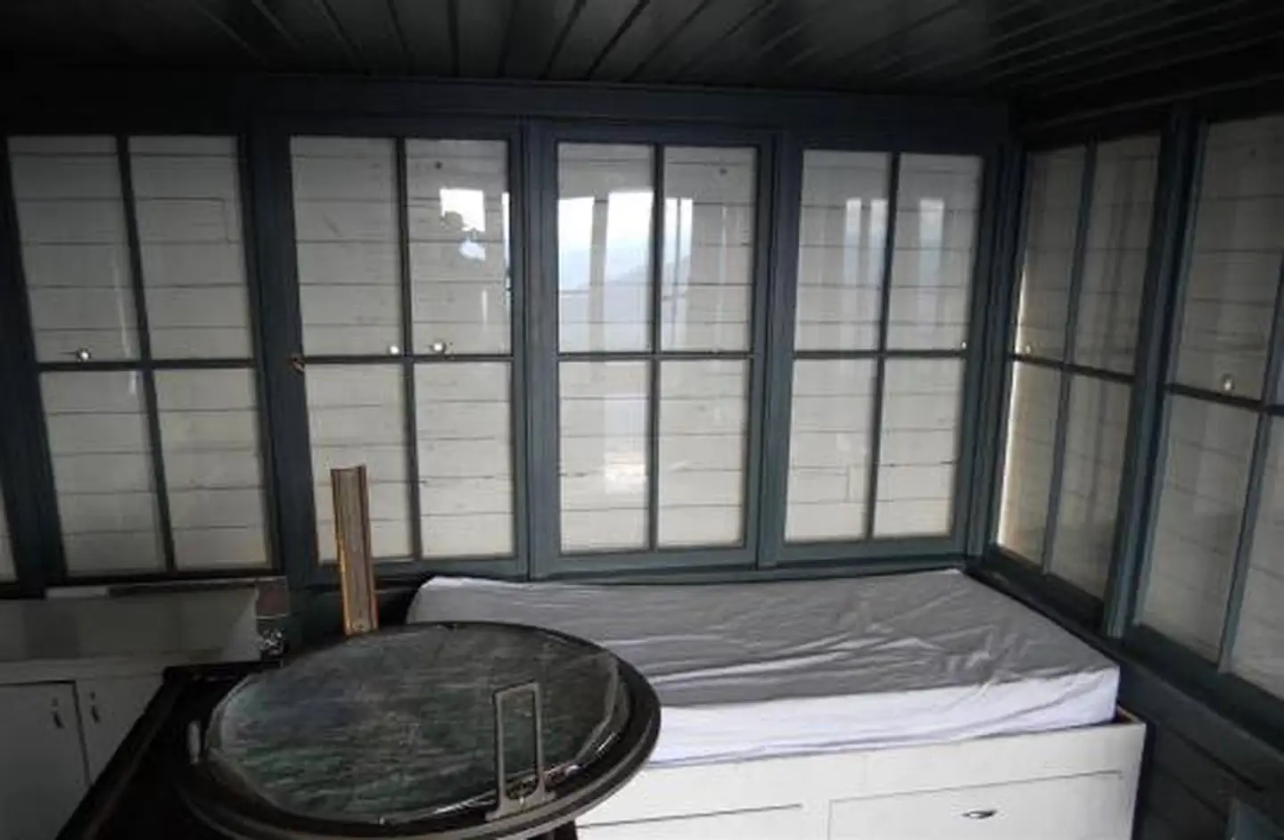
Photo: Recreation.gov
About
The Cougar Peak Lookout offers guests an opportunity to experience an old-time Forest Service lookout. The tower commands an impressive view of the river valley, the surrounding Cabinet Mountains and the opposing Coeur d'Alene Mountains. The structure is small and is not elevated like many other lookouts. The lookout can be accessed by vehicle, although late spring snow drifts may compromise parts of the road, requiring visitors to hike a short distance. Guests are responsible for their own travel arrangements and safety, and must bring several of their own amenities.For facility specific information, please call (406) 210-5287.The 14-by-14 structure is small, but can accommodate up to four people. There is a full bed for two with a mattress pad, a table with two chairs, and a wood stove. No other furnishings are provided. A rustic outhouse with a vault toilet is available about 200 feet from the lookout, at the parking area. Guests will need to bring water for drinking, cooking and cleaning purposes, as well as their own bedding and cots for additional sleeping options, cooking and eating equipment and fuel, cooking and eating utensils, flashlights, matches and toilet paper, among other necessities. There is no water available at the site. There is room for a small tent outside the tower. Guests should be prepared for cold and often wet or damp weather, even if the weather in the valley is warm and dry. Food, garbage and other waste needs to be put away at all times to avoid attracting bears. Firewood may be collected locally for the wood stove.The tower is situated in the Clark Fork River drainage, at an elevation of 6,694 feet, in the Cabinet Mountains of western Montana. It was built in 1952 to replace an existing, older structure dating back to the 1930s. The lookout was part of the old Cabinet National Forest, which was divided by the Forest Service in 1954 to become the Lolo National Forest. The 2 million-acre forest includes four wilderness areas and a wide variety of trees, plants and wildlife. The area is home to mountain goats, bighorn sheep, elk, moose, deer and grizzly and black bears ( learn more about bear safety ). Both the bald and golden eagle reside in the forest, along with trumpeter swan, herons and dozens of varieties of ducks.A variety of trails and points of exploration are accessible from the lookout. The Cougar Peak Trail follows the ridge below the lookout and travels towards Vermillion Pass to the northeast. The Clark Fork River
Directions
From Thompson Falls, Montana, travel west on Highway 200 for about a mile. Before crossing the Clark Fork River bridge, turn right onto Blue Slide Road and continue about 8 miles, to the junction with Forest Road 403. Turn right and travel about 14 miles to the lookout. Maps are available online or for purchase by calling the Plains/Thompson Falls Ranger District.
Location
Map tiles © OpenStreetMap.
Details
- State
- Montana
- City / area
- Thompson Falls
- Agency
- USDA Forest Service
- Parent area
- Lolo National Forest
- Campsites
- 1
- Reservable
- Yes
- Typical price
- $45 / night
- Rating
- 4.92 / 5 (24 reviews on Recreation.gov)
- Equipment
- See Recreation.gov
Nearby campgrounds
- SEX PEAK. LOOKOUT RENTAL 19.7 km away
- Big Hole Lookout (MT) 28.1 km away
- MINTON PEAK LOOKOUT 30.4 km away
- BEND GUARD STATION 31.1 km away
- Savenac East Cottage (MT) 39.9 km away
- SAVENAC WEST COTTAGE 39.9 km away